15 Best Autumn Hiking Trails In Europe [Perfect For Photography]
Autumn, with its crisp air, golden leaves, and wide-open skies, is one of the best times to hit the trails. It’s that perfect moment when nature puts on its final show before winter rolls in, and the paths feel just a little quieter, a little more peaceful.
The days might be getting shorter, but that doesn’t mean your adventures have to slow down. In fact, they might just be getting started. So grab your backpack, throw in a few essentials, and get ready to explore some of the most unforgettable trails across Europe.
The Jamtland Triangle, Sweden
A Journey Through Sweden’s Untamed Beauty | 3 Days Hiking the Jämtland Triangle
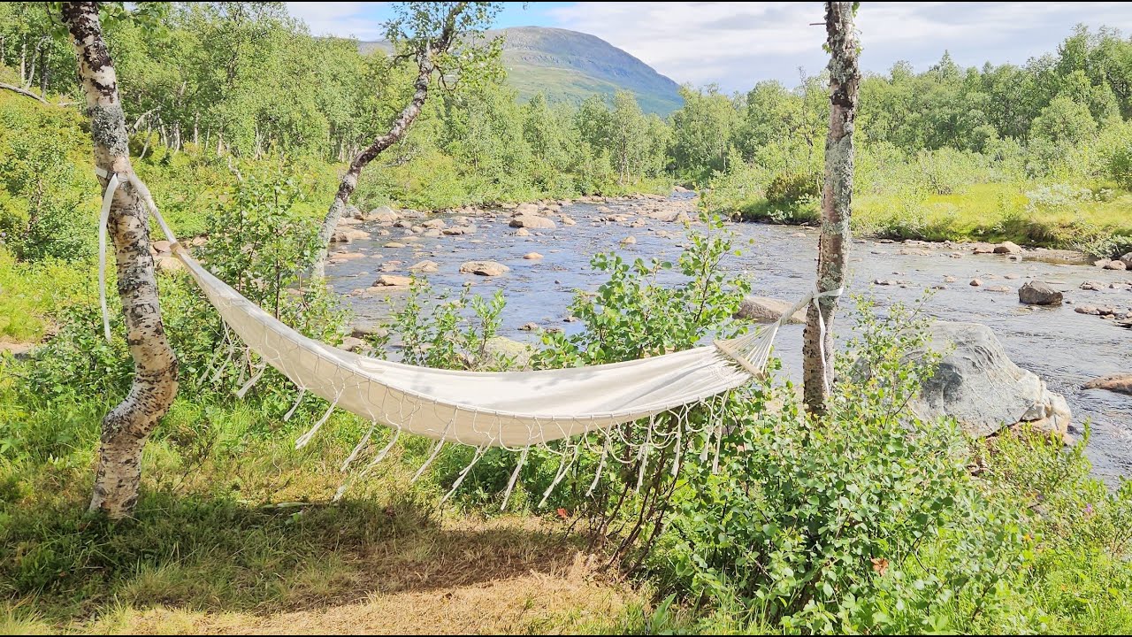
The Jamtland Triangle is a 3-day hike that takes you from one mountain hut to another in Jamtland County, Sweden. You’ll likely see reindeer since you're walking right through their home.
The hike starts and ends at STF Storulvan Mountain Station. From there, you can hike either clockwise or counter-clockwise. If you go counter-clockwise, your first day is a 12 km walk to STF Blahammaren. The second day is the longest, with a 19 km hike to STF Sylarna. On the third day, you walk 16 km back to where you started.
If you want to carry less gear, you can stay in mountain huts. There, you can take a hot shower and eat local meals. Or, you can camp for free near the huts and use the hut facilities.
The distances between huts are not too long, so they’re easy to cover during shorter autumn days. The wide open landscapes offer amazing sunrises, sunsets, and maybe even the Northern Lights if you're lucky, perfect for those looking to sell photos online.
This hike is perfect for those who are new to hiking trips. You’ll meet other hikers along the way, and each day ends at a safe place. Plus, there’s good mobile phone signal in the area!
Mull Of Galloway Trail, Scotland
Visiting The Most Southerly Point Of Scotland, Mull Of Galloway 🏴
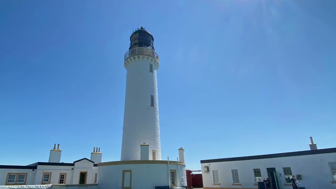
The Mull of Galloway Trail is a 40-kilometre walking route in southern Scotland. It starts at the lighthouse at the Mull of Galloway, which is the southernmost point of mainland Scotland, and ends in the town of Stranraer. Much of the trail follows the eastern coastline of the Rhins of Galloway, a quiet and scenic peninsula.
The walk passes through beautiful landscapes, including the RSPB nature reserve at the Mull, sandy beaches, peaceful villages, and countryside paths. While the trail often runs close to roads, it makes use of coastal paths where possible and offers pleasant walking for most of the way.
The route can be extended by joining it with the Loch Ryan Coastal Path at its northern end. This path connects to the Ayrshire Coastal Path, making it possible to continue on a longer journey along the coast.
From the Mull to Clayshant, the trail stays near the coast and is usually close to the road. It is mostly well marked, though some parts are walked less often and may feel overgrown. After Clayshant, the route continues along minor roads and rural paths.
As you near the end of the trail from Stranraer to Cairnryan, the path follows the coast again. However, beyond Cairnryan, the trail becomes more difficult as it crosses wet and boggy moorland for the final stretch.
Jotunheimen Runde, Norway
Jotunheimen, My Favorite Loop Hike. Backpacking, Camping & Hiking Norway in the Fall. HDR
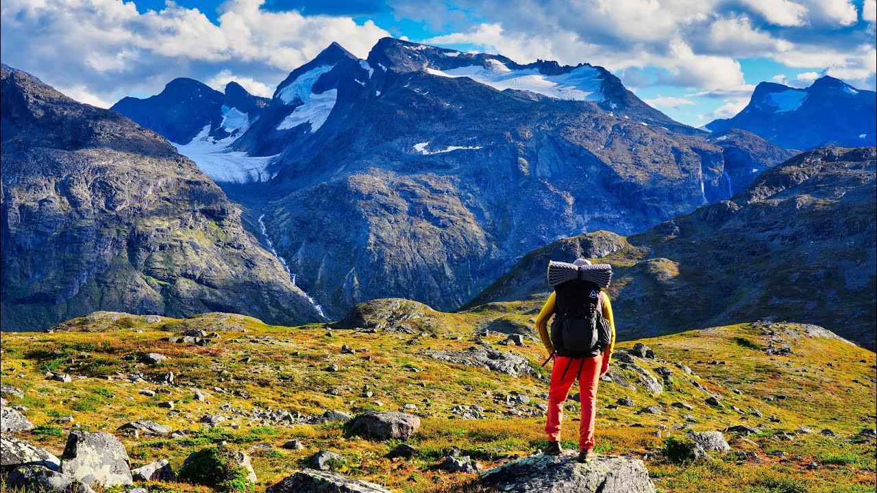
The Jotunheimen Runde is a 76-kilometer hiking trail in the middle of Jotunheimen National Park, Norway. The name "Jotunheimen" means "home of the giants" from old Norse stories. In the 1800s, poets, explorers, and hikers started coming to see the amazing mountain views, making the area popular.
Later, the Norwegian Trekking Association (DNT) built cabins and marked trails to help people explore the region. One of the first DNT cabins, Gjendesheim, opened in 1878 and is still used today. The Jotunheimen Runde was made by connecting some of these older trails into one big loop that shows off the wild beauty of the area.
Most people take about four days to walk the whole trail, and it's considered hard. It goes through valleys, over high mountain passes, and past glaciers and lakes. There are no stores along the way, so hikers must bring all their own food. However, there are many streams and springs for drinking water, just make sure to filter it before drinking.
A great time to hike the Jotunheimen Runde is in early autumn, from September to early October. At this time, the trail is less crowded because most tourists have left. The weather is cool and fresh, and the trees and moss change color, making the scenery even more beautiful. Most DNT cabins close by mid-September, so hikers need to bring a tent or shelter.
Old Man Of Hoy, Scotland
A Visit to the Old Man of Hoy in Orkney
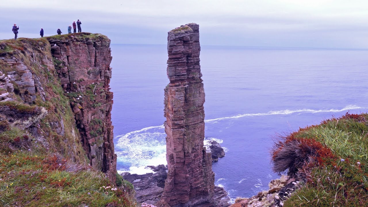
The Old Man of Hoy is a famous landmark that many tourists visit when traveling around the Orkney Islands in Scotland. Most people take a short bus trip to Rackwick village and follow an easy path to a viewpoint. But what if you made it more exciting?
One thing to know, you’ll need good waterproof boots, because the trail along the cliffs can be very muddy. The full hike is a 20km loop that starts and ends at Moaness Harbour. After walking 2km along the road, you’ll reach the base of Cuilags mountain, where the steep climb begins. Once at the top, you’ll enjoy amazing views across Hoy Sound to the Orkney mainland and the small island of Graemsay.
As you come down the mountain, you’ll walk along a wet, boggy coastal path. Try to stay close to the cliff edge so you don’t miss the stunning St John’s Head, the tallest vertical cliff in the UK. This remote area is peaceful and wild, with only birds like gulls and fulmars living on the cliffs.
After passing the cliffs, the path gets better, and soon you’ll see the top of the Old Man of Hoy. Keep walking until you find a trail leading downward. You can choose to camp near the cliffs or walk down to Rackwick, where there’s a simple shelter called a bothy to sleep in.
Tour Matterhorn, Italy And Switzerland
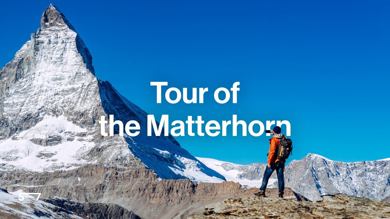
Tour du Matterhorn: Hiking Around Europe's Most Iconic Peak
Join a 7-day hiking adventure to experience the famous Matterhorn in Switzerland. This hike takes you through beautiful landscapes around Zermatt, a top destination for mountain lovers.
During the hike, you’ll see amazing views of the Matterhorn from different sides and walk from green valleys up to rocky, high-altitude terrain. Along the way, you’ll enjoy wide views of tall mountains, glaciers, and streams fed by melting snow.
You’ll pass through open fields with grazing cows, and at the end of each day, you can rest in cozy mountain huts or hotels. These places are perfect for watching stunning sunsets, and if you wake up early, you might catch a beautiful sunrise too.
The trip includes a mix of stays in mountain huts and hotels, some with dorm beds and others offering private rooms (which need to be booked well in advance). The route is planned to show you the best sights and scenery the area has to offer.
To make your trip easy and enjoyable, we handle all the details. This includes booking your accommodation and giving you a clear guidebook and GPS route maps. All you have to do is enjoy the breathtaking views and have a great hiking experience.
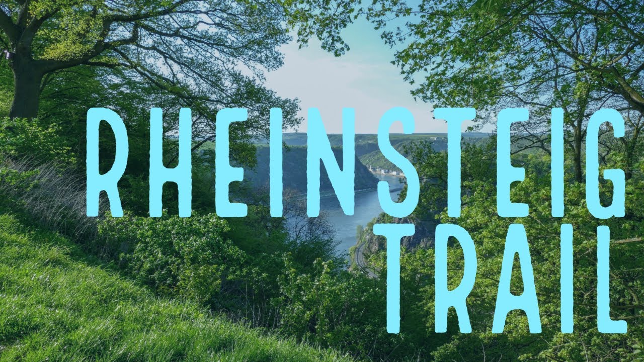
Rheinsteig Trail, Germany
Rheinsteig Hike (15: Königsetappe) in Germany 4K
The Rheinsteig trail is a beautiful hike that mixes luxury with adventure. It stretches about 320 kilometers from Bonn to Wiesbaden. The hiking is not too hard, with paths going up and down between cliffs and the river.
The Rheinsteig isn’t a loop trail, but you can take ferries or trains back to your starting point. Many towns along the way offer these services. If you only have three days, hiking from St. Goar to Lorch am Rhein is the best. On this part, you’ll pass many castles, including one on an island in the Rhine River. Be sure to stop and visit some of them, like Burg Rheinfels and Pfalzgrafenstein Castle.
Autumn is a great time to go because it’s harvest season in the vineyards. Winemakers often invite hikers to taste fresh grape juice. At night, you can stay in cozy inns or even castle hotels, where you can enjoy fine food and relax. There are also luggage services so you don’t have to carry heavy bags, just bring a small backpack with what you need for the day and lunch to eat on the trail.
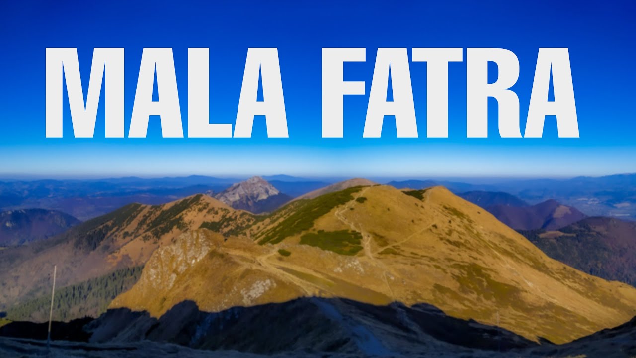
Mala Fatra Ridge, Slovakia
Mala Fatra: hiking hidden gem of Slovakia
Mala Fatra is a mountain range in northwestern Slovakia, not far from the city of Zilina. Autumn is a perfect time to visit this small national park. One great way to explore Mala Fatra is to hike along the main ridge.
You can start in Stefanova and finish in Varin or Nezbudska Lucka. The hike is over 33 km long and can be done in 2 or 3 days. Along the way, there are two mountain huts: Chata pod Chlebom and Chata pod Suchym. These are good places to sleep and enjoy homemade meals.
This hike is a good first try at multi-day hiking because it’s not too long and has comfortable places to stay. That said, the hike still has its challenges. The total climb is about 2,300 meters, and some parts are rocky and a bit exposed. So, you should be in good shape and have some experience with scrambling.
The highest peak, Velky Krivan (1,709 meters), is a short 15-minute walk off the main path and worth the trip. There are several places where you can start or leave the trail, so it's possible to exit early if needed. There's even a cable car that takes you up to the ridge between the peaks of Chleb and Velky Krivan. With that and the two mountain huts along the ridge, you're never too far from help or comfort, even though you're in the mountains.
Related: Unforgettable Ways To Explore Scotland’s Autumn Beauty
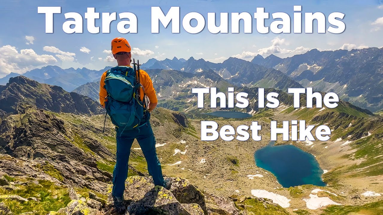
Tatra Mountains, Poland
Tatra Mountains: This Is The Best Hike In Poland!
Autumn is the best time to hike in the Tatra Mountains. The main reasons are fewer people on the trails and in the huts, and the beautiful fall colors, especially in the Western Tatras.
If you plan a multi-day hike, it likely won’t be a loop. Once you’re up in the mountains, you’ll mostly walk along ridges, with some paths leading down to the huts. The only places to stay are mountain huts because camping isn't allowed in Tatra National Park.
There are 8 huts in total, each with different sizes and how many people they can hold. All of them serve homemade food, snacks, and drinks. They also have electricity and running water.
Getting to any trailhead from Zakopane is easy, no matter where you choose to start your hike. The length of your trip can vary, from just two days to a whole week, depending on which route you take. Staying in huts means you can pack light, meet other hikers, and enjoy peaceful evenings near tall peaks, with clear skies and stars above.
The West Highland Way, Scotland
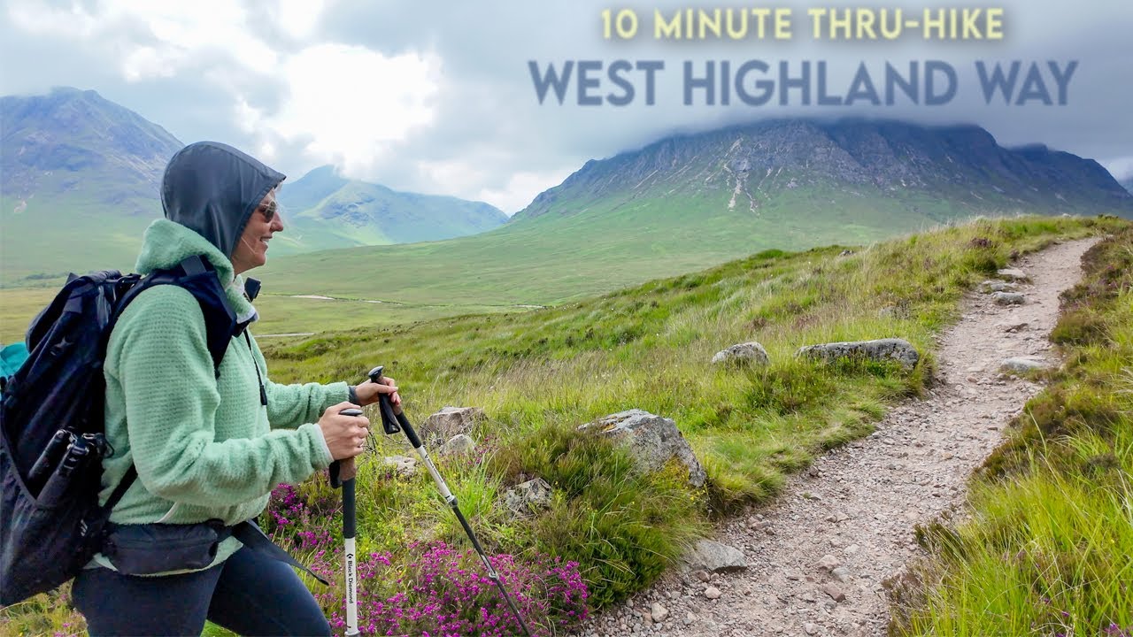
The Entire West Highland Way in 10 Minutes
The West Highland Way is the most famous long-distance hiking trail in Scotland. It is 96 miles long and starts near Glasgow, in a town called Milngavie (pronounced "mil-guy"). From there, it goes past Loch Lomond, crosses into the Scottish Highlands, passes through Glencoe, and ends in Fort William, the town at the foot of Ben Nevis, the UK’s tallest mountain (1,345 meters high).
Some special places along the route include Conic Hill, Rannoch Moor (a wild and open area), and Buachaille Etive Mòr (a big mountain that looks amazing as you climb the Devil’s Staircase).
The West Highland Way was first opened in 1980 and was the first long-distance walking trail in Scotland. It helped inspire many other great trails across the country. Because of its mix of peaceful lowland views and dramatic mountain scenery, it's considered one of the best hikes not just in Scotland, but in the world.
Hetta To Pallas, Finland
Hetta - Pallas hiking trail in Northern Finland
Ruska is a Finnish word that describes the amazing autumn colors in Lapland before snow covers everything for months. Trees like birch, aspen, and mountain ash turn bright orange and red, it’s truly beautiful! Once you see it, you’ll never forget it. This is Lapland at its finest!
That alone shows how perfect autumn is for this hike. But there’s more, you might also see the Northern Lights! And you can stay in simple but comfortable huts along the way, keeping warm through the night before your next day of hiking. Halfway through the hike, you can even relax in a real wood-heated sauna. How cool is that?
To get to the start of the trail in Hetta, yo can take a car or taxi, then a boat across the lake. Once you cross Lake Ounasjärvi, you’ll have about 55 kilometers of hiking ahead. You can finish the hike in 3 or 4 days, staying in huts along the route. You need to carry all your food and gear with you. If you prefer camping, you can pitch your tent anywhere for free, but it’s best to camp near the huts.
Great Glen Way, Scotland
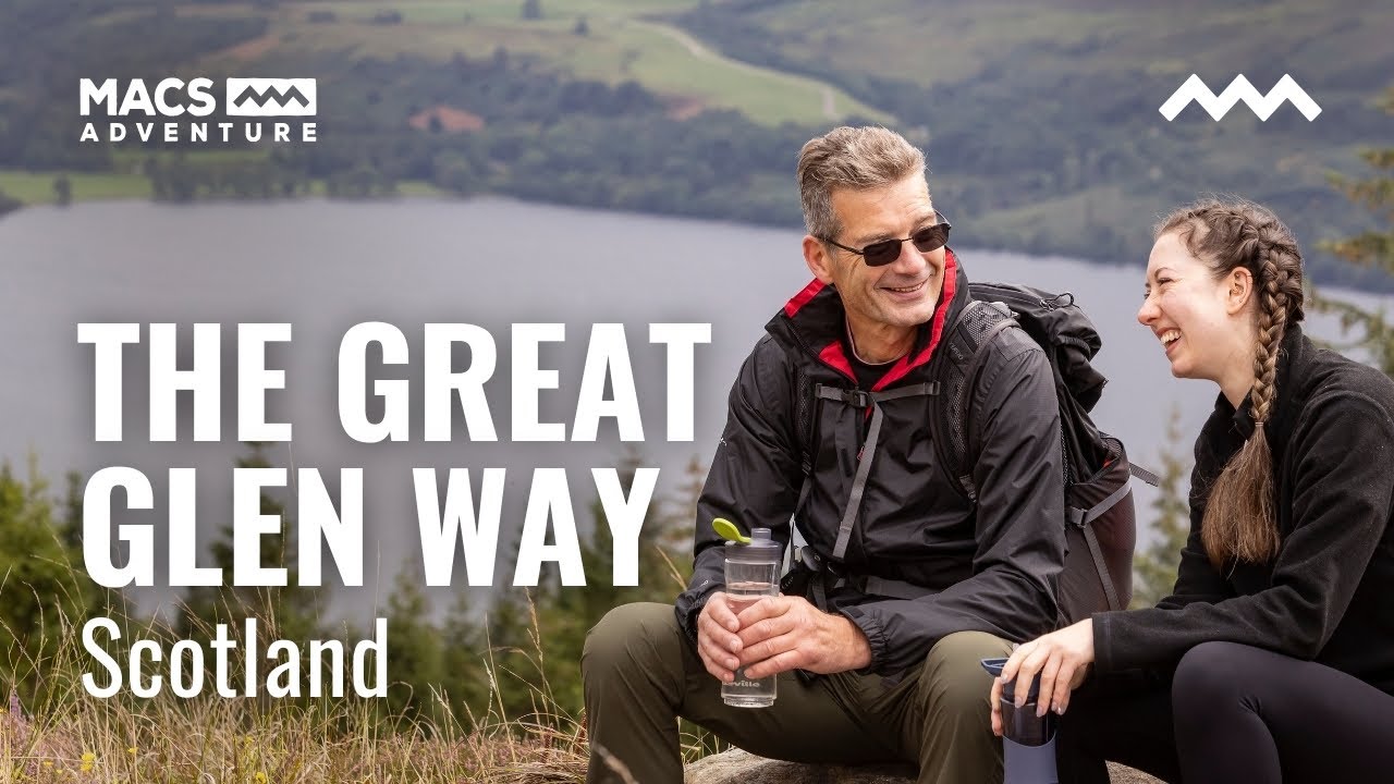
Hiking the Great Glen Way | Scotland’s Classic Highland Trail Along Loch Ness | Macs Adventure
The Great Glen Way starts at the ruins of Old Fort William and runs through Scotland’s longest valley, called the Great Glen. The path follows the Caledonian Canal, forest trails, and old roads. Along the way, it passes three big lakes: Loch Lochy, Loch Oich, and Loch Ness.
There are villages with places to stay and shops, and there's also an optional detour near Invergarry. The route ends in Inverness, the capital of the Highlands, at Inverness Castle. This path is mainly for hiking, but mountain bikes can use it too if riders are careful around others.
From Fort William, the start is easy hiking, but after Fort Augustus (the halfway point), the path goes up and down more, especially on the High Route. The High Route climbs a total of 1835 meters (6020 feet), with some steep parts that are not good for cyclists. If you take the original route instead, the total climb is only 1230 meters (4035 feet). The highest point on the High Route is 422 meters (1385 feet), between Invermoriston and Drumnadrochit.
Sections of the route range from 9 to 20 miles (14-32 km). Most people prefer to split the longest section, between Drumnadrochit and Inverness, into two days, maybe using a bus or boat between Blackfold and Inverness, or camping at Abriachan. The path changes a lot along the way: you’ll walk on canal paths, forest trails, old roads used long ago, military roads, new walking paths, and city sidewalks.
The Camino De Santiago, Spain

This is the Camino | (Camino de Santiago in 6 minutes)
The Camino de Santiago is a famous hiking route that many hikers dream of doing. Autumn is a great time to walk this 500-mile path across Spain’s Iberian Peninsula.
There are many different routes for the Camino, but the most popular one, the Camino Frances, starts in Saint-Jean-Pied-de-Port, a town in France, and ends in Santiago de Compostela, Spain. This city is about 45 kilometers from the Atlantic Ocean.
Walking the full route usually takes 35-40 days, but many people do it in smaller parts. You can hike just a few days or a week at a time. The difficulty varies, some parts are easy, others more challenging, but the trails are well marked and in good condition. If you're reasonably fit and ready to walk long distances, you’ll enjoy the Camino.
This hike takes you through big cities and small villages. There are no campsites along the way, but there are many albergues, which are special hostels or guesthouses for pilgrims. Walking in autumn means you’ll likely find a bed waiting when you arrive each day.
People hike the Camino all year, but autumn is especially nice. The weather is cool, and there’s little rain, unlike winter and spring which can be wet, and summer which can be very hot. Autumn is also a quieter time, so you’ll avoid the large crowds that come in the summer.
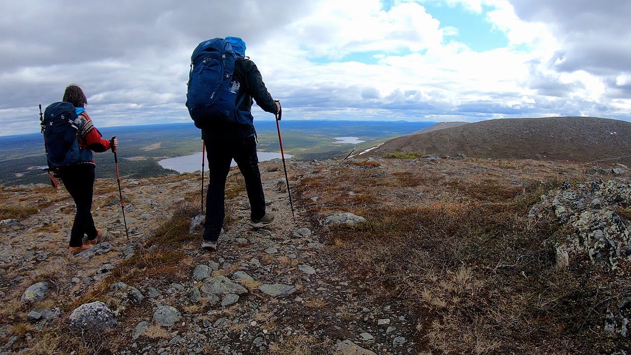
Rago National Park, Norway
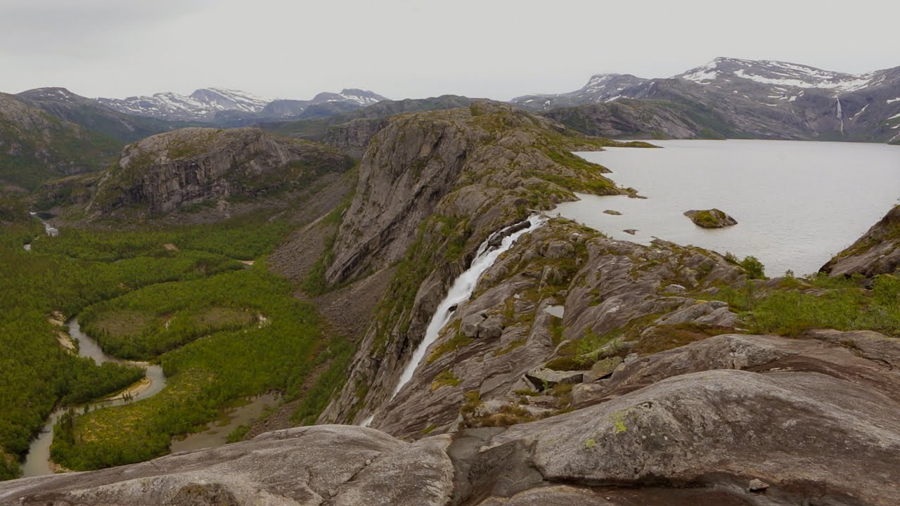
Hiking Rago National Park
Rago National Park is in northern Norway, in Nordland county. It’s next to several Swedish national parks, Padjelanta, Sarek, and Stora Sjöfallet, which makes it a great place for long hikes in wild and untouched nature. But for an autumn adventure, take a two-day hike that shows you the best of Rago!
The route is a loop and starts and ends just east of Nordfjord. There’s a parking area with picnic tables, a dry toilet, and a wind shelter. Over two days, you’ll walk about 25 km and pass Lake Litlverivatnet and the stunning Litlverivassforsen waterfall, which is one of the tallest in northern Norway at 223 meters high! The views keep coming as you hike across large rock slabs at Solvskaret, walk through alpine forests, and reach the beautiful Lake Storskogvatnet.
You have two options for sleeping: you can camp anywhere (which is great if you want to see the Northern Lights), or stay in a small hut near Storskogvatnet. The hut offers shelter from bad weather, but has only 4 beds and might be full when you arrive. Also, staying there means walking 18 km on the first day and just 7 km on the second.
South West Coastal Path, England
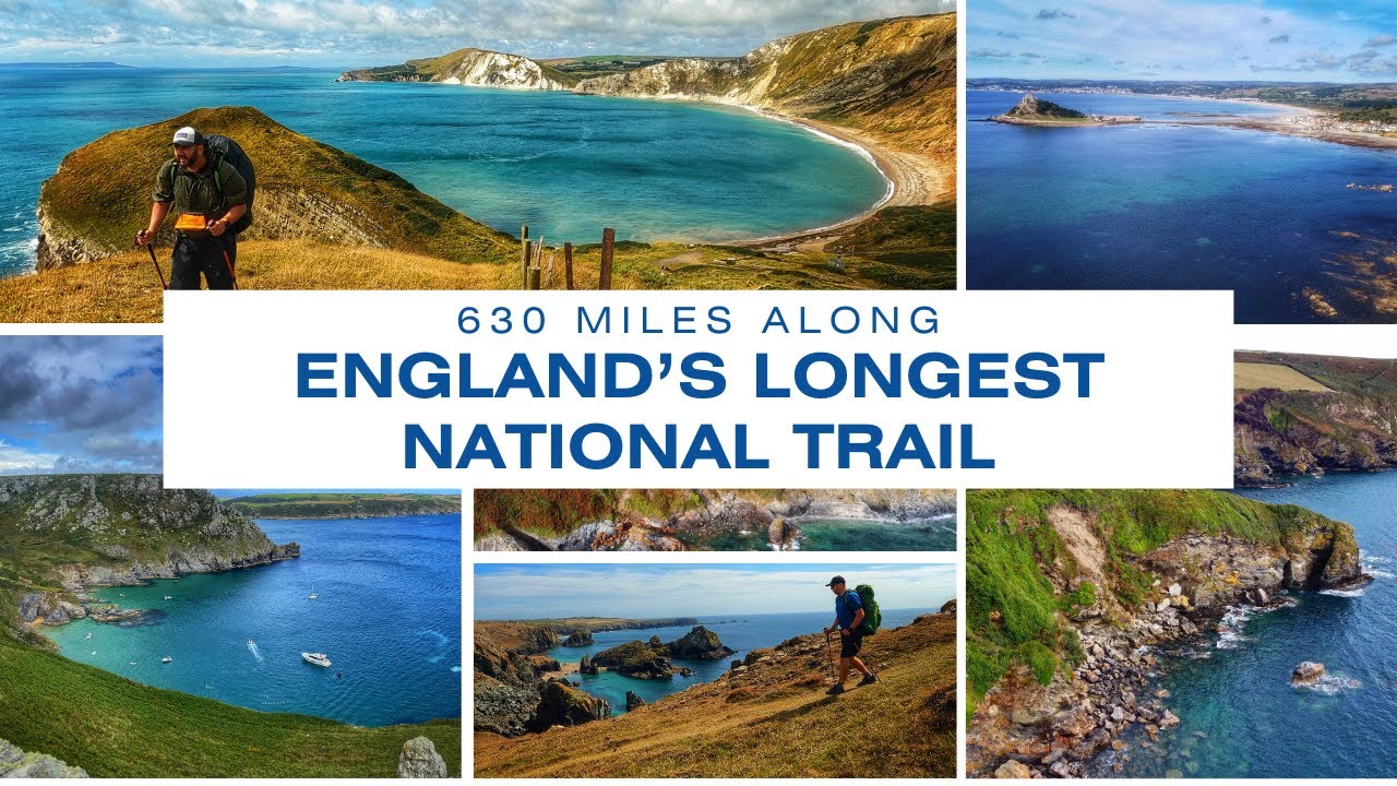
England's Longest National Trail / South West Coast Path / 630 Miles
Most tourists who visit the coasts of Cornwall and Devon don’t realize that the South West Coastal Path, the stretch of coastline along the southwest corner of England, looks even more beautiful later in the year. It’s quiet and not crowded, with views over beaches and bays that are free from crowds of sunbathers and children playing with buckets and spades.
The path starts in Minehead, Somerset, and ends in Poole, Dorset, but you can choose any part of the route if you prefer a shorter trip. It doesn't have to be done all at once, you can take breaks or spend time exploring towns or famous coastal spots in Cornwall.
The full path is about 600 miles long and fast walkers usually finish it in around 30 days, while those who like to take their time and enjoy the scenery often take 8 weeks or more. Most people camp along the way, but many also stay in BnBs. Although the path is well maintained, there are some steep ups and downs, so it’s considered moderately difficult.
Rila Traverse Trail, Bulgaria
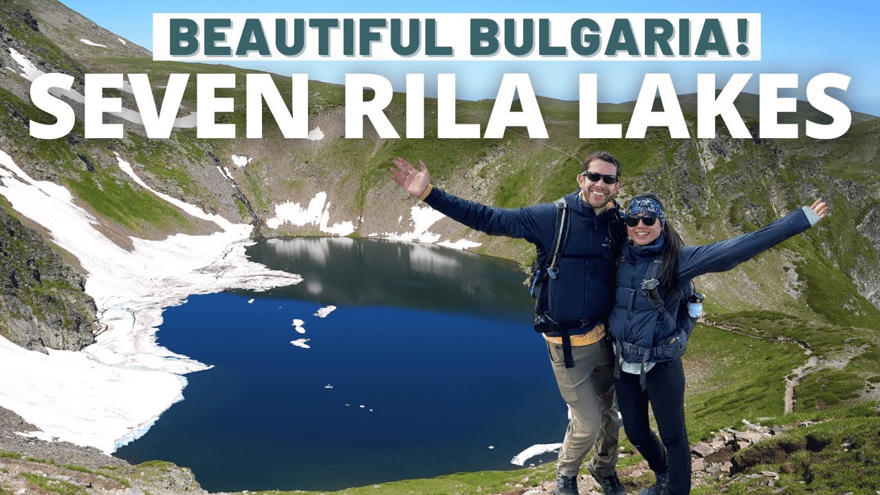
Seven Rila Lakes & Rila Monastery | Must-See Places in Bulgaria 🇧🇬
Just 70 kilometers from Bulgaria’s capital, the Rila Mountains cover over 2,400 square kilometers. They are home to some of the highest peaks in the Balkans, like Mount Vihren (2,914 meters) and Mount Musala (2,925 meters).
The Rila Traverse is a 7-day hiking trip that goes from mountain hut to mountain hut. It’s 74 kilometers long and passes through beautiful landscapes with deep valleys, alpine meadows, rocky peaks, and almost 200 glacial lakes. The trails are well marked with colored stripes and metal poles in some places.
Camping is not allowed in the national park, but there are several mountain huts open during the summer and autumn. These huts make it easier to plan your hike, but the steep climbs still need good fitness. Because of this, the full trail is best for experienced hikers.
Autumn, especially September, is the best time to hike here. You’ll avoid the crowds and still have dry, sunny weather. The hike starts in Borovets, where you take a cable car up to Yastrebets Hut, and ends at Malyovitsa Hut.
A big highlight is reaching the top of Mount Musala, the highest peak in the Balkans. And after all the walking, you can relax in natural hot springs found in the area.
Conclusion
The best part? These hikes aren’t just about reaching the destination, although those viewpoints are pretty spectacular. They’re about the stories you collect along the way: the people you meet, the meals shared in mountain huts, the unexpected detours, and the moments where everything feels perfectly still. So if you're looking for a reason to step outside and see what’s out there, now’s the time. Autumn won’t wait, and neither should you.
You Might Like: Unforgettable Autumn Adventures In Wales